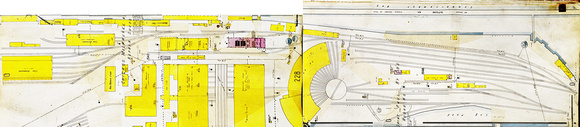
The map is turned so north is at the top. The building in purple is the sub-station. These maps were from 1930, and at some point thereafter, the log pond on the south side of the map was filled in, and the yard leads went parallel to the bottom of the map, and continued west to the yards on either side of the Milwaukee Waterway.
NIKON CORPORATION NIKON D3100, f/7.1 @ 28 mm, 1/60, ISO 400, No Flash
© Tim J.Johnson Photography